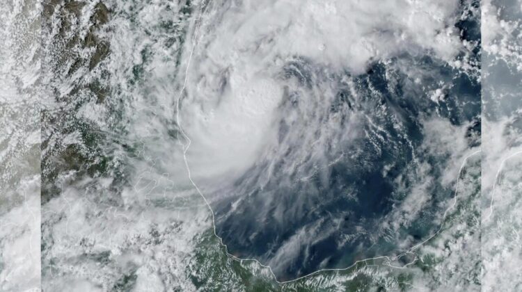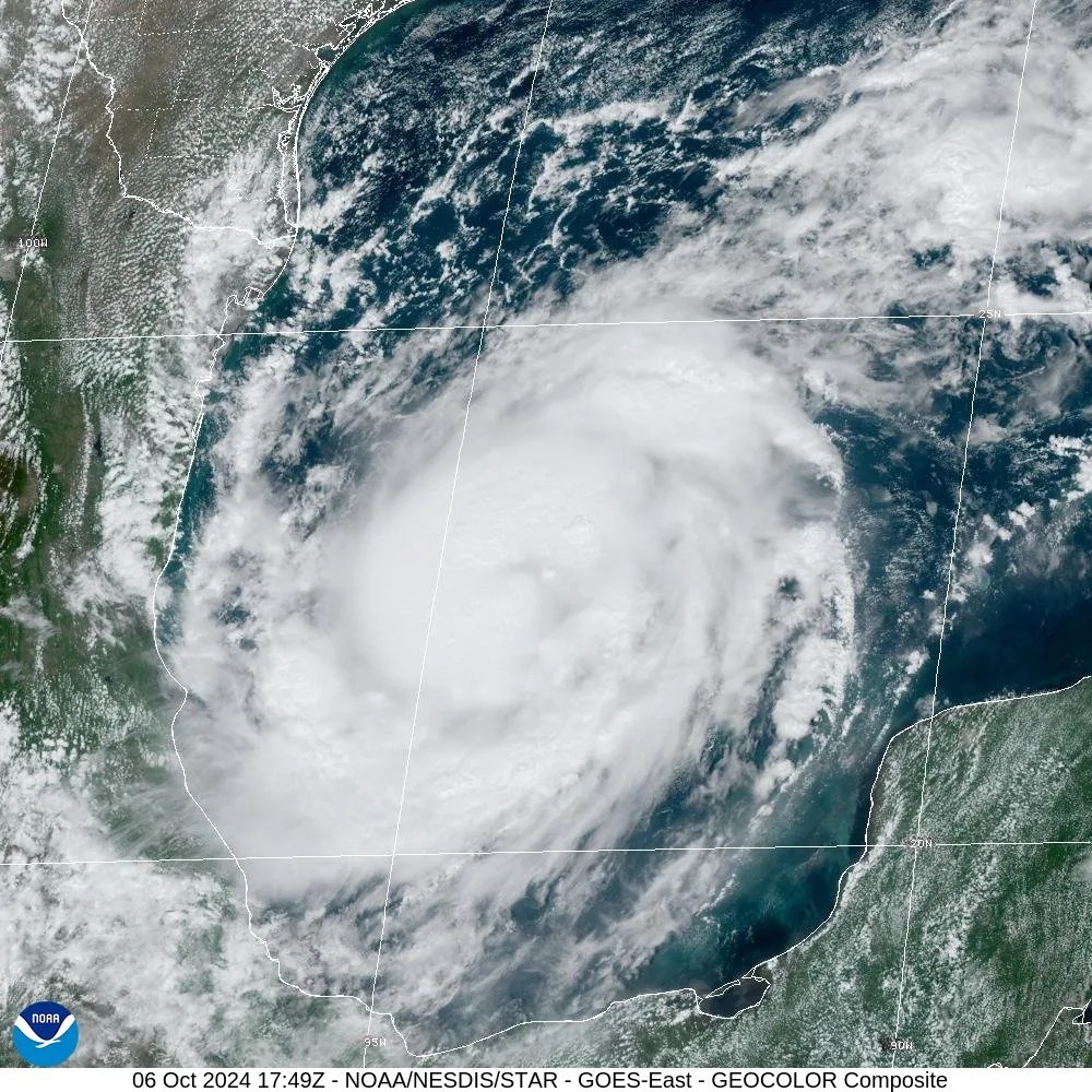
As hurricane season continues to batter the Gulf Coast, Hurricane Milton is projected to make landfall in Florida as a Category 3 storm this week. Forming in the Gulf of Mexico on Saturday, Milton quickly gained strength, reaching Category 1 status on Sunday, and is expected to escalate to a powerful Category 3 hurricane by Wednesday. The storm is set to hit the west coast of Tampa, Florida, bringing life-threatening storm surges, heavy rainfall, and destructive winds.
Tracking Hurricane Milton’s Path and Strength
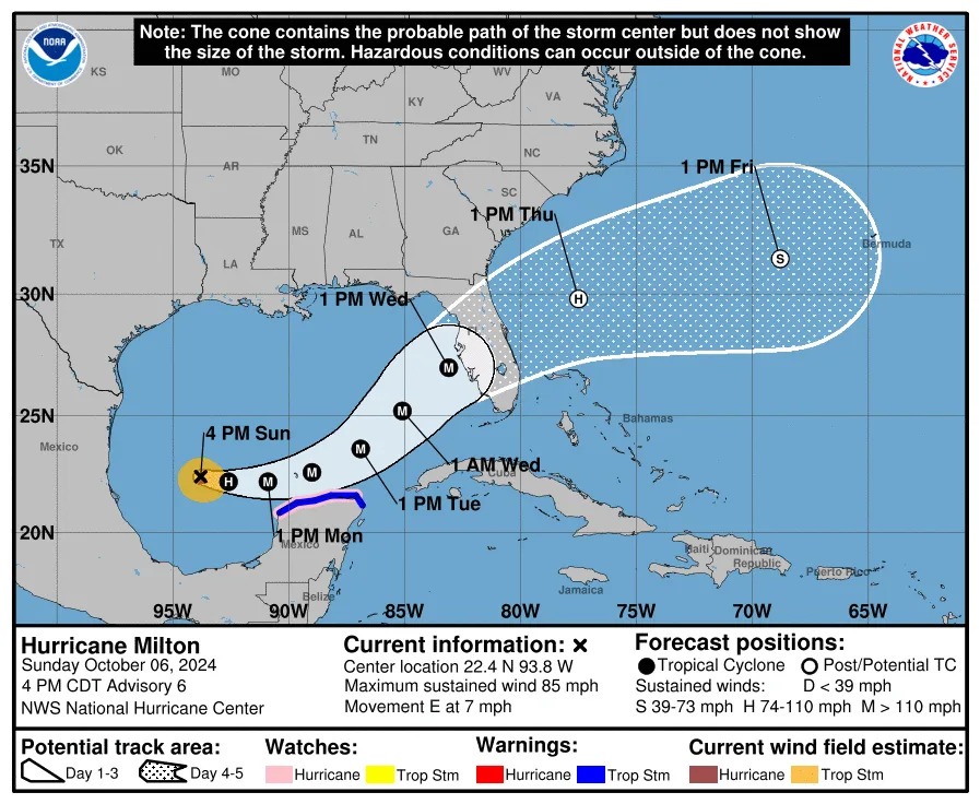
As of Sunday, Hurricane Milton was located 275 miles west-northwest of Progreso, Mexico, and 805 miles southwest of Tampa, Florida. Moving at 7 mph with sustained winds of 85 mph, Milton is expected to intensify, with maximum sustained winds potentially reaching between 111 to 129 mph. These wind speeds will categorize Milton as a Category 3 hurricane, according to the National Hurricane Center (NHC).

The storm’s projected path puts the west coast of Florida at significant risk. By Wednesday, residents of the Florida Peninsula, Florida Keys, and the northwestern Bahamas should prepare for intense rainfall, flooding, and damaging winds.
Florida Braces for Impact
Governor Ron DeSantis has declared a state of emergency across 51 counties in Florida, preparing for the evacuation of over 6 million residents. This comes on the heels of Hurricane Helene’s devastation, which caused over 20 deaths and left widespread destruction in Florida just a week ago.
President Joe Biden has been briefed on the situation, and FEMA is already working on preparing emergency services and resources ahead of Milton’s landfall. The Mexican government has also issued a Hurricane Watch for the coast of Mexico from Celestún to Cabo Catoche.
What to Expect: Storm Surges, Rainfall, and Flooding
Hurricane Milton is expected to bring significant storm surges along Florida’s west coast. Water levels may rise by 2 to 4 feet above ground level in certain areas, coupled with dangerous waves. Rainfall projections estimate 5 to 10 inches across the Florida Peninsula, with localized totals of up to 15 inches, which can cause flash flooding, urban flooding, and even moderate to major river flooding.

Residents in Milton’s projected path are urged to finalize hurricane plans and monitor updates from the NHC as the storm progresses.
Hurricane Kirk Diminishes
While Milton gains strength, Hurricane Kirk has diminished to a Category 2 hurricane and continues to move north-northeastward over open waters. As of Sunday, no coastal watches or warnings were in effect for Kirk.
Aftermath of Hurricane Helene
Florida is still recovering from Hurricane Helene, which made landfall in Florida’s Big Bend region as a Category 4 storm last week. The storm left over 200 people dead and caused significant damage to infrastructure and utilities, with over 350,000 utility customers still without power. Hurricane Milton now threatens to exacerbate the situation, adding strain to the state’s already stretched emergency services.

Peak of Hurricane Season
The Atlantic hurricane season, which runs from June 1 through November 30, is nearing its peak. The National Oceanic and Atmospheric Administration (NOAA) typically expects around 14 named storms in a season, with seven becoming hurricanes. However, this year’s activity is ahead of schedule, with Milton being the 13th named storm of the season, weeks earlier than the historical average.
What’s Next?
With the frequency and intensity of hurricanes increasing due to climate change, the rest of the 2024 hurricane season is likely to remain active. The federal government and local authorities are working around the clock to prepare for Milton’s landfall, but the long-term impacts of back-to-back storms like Helene and Milton will be felt by Florida’s residents and infrastructure for months to come.
Residents in Florida and surrounding areas are urged to stay informed and heed evacuation orders as Hurricane Milton approaches.

Leave a Reply