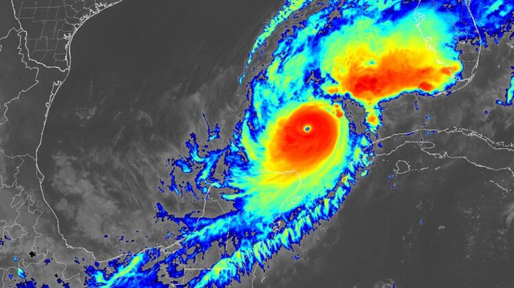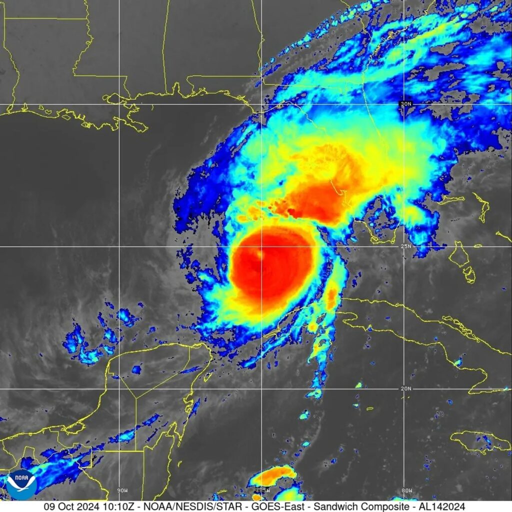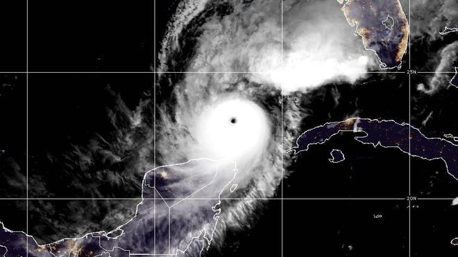
Hurricane Milton, expected to be one of the most destructive Atlantic storms in recent years, is currently traveling across the Gulf of Mexico and is set to make landfall tonight (Wednesday, October 9) on the west coast of Florida around Tampa and Sarasota.
As of Wednesday morning, Hurricane Milton has returned to being classed as a Category 5 storm, with maximum sustained wind speeds of 260 kilometers (160 miles) per hour, according to the National Oceanic and Atmospheric Administration’s National Hurricane Center.
While those wind speeds are slightly lower than yesterday, the storm is still set to be a brutal one with a massive wind field. The National Hurricane Center reportedly said Tuesday: “The official forecast shows the hurricane and tropical storm-force winds roughly doubling in size by the time it makes landfall.”

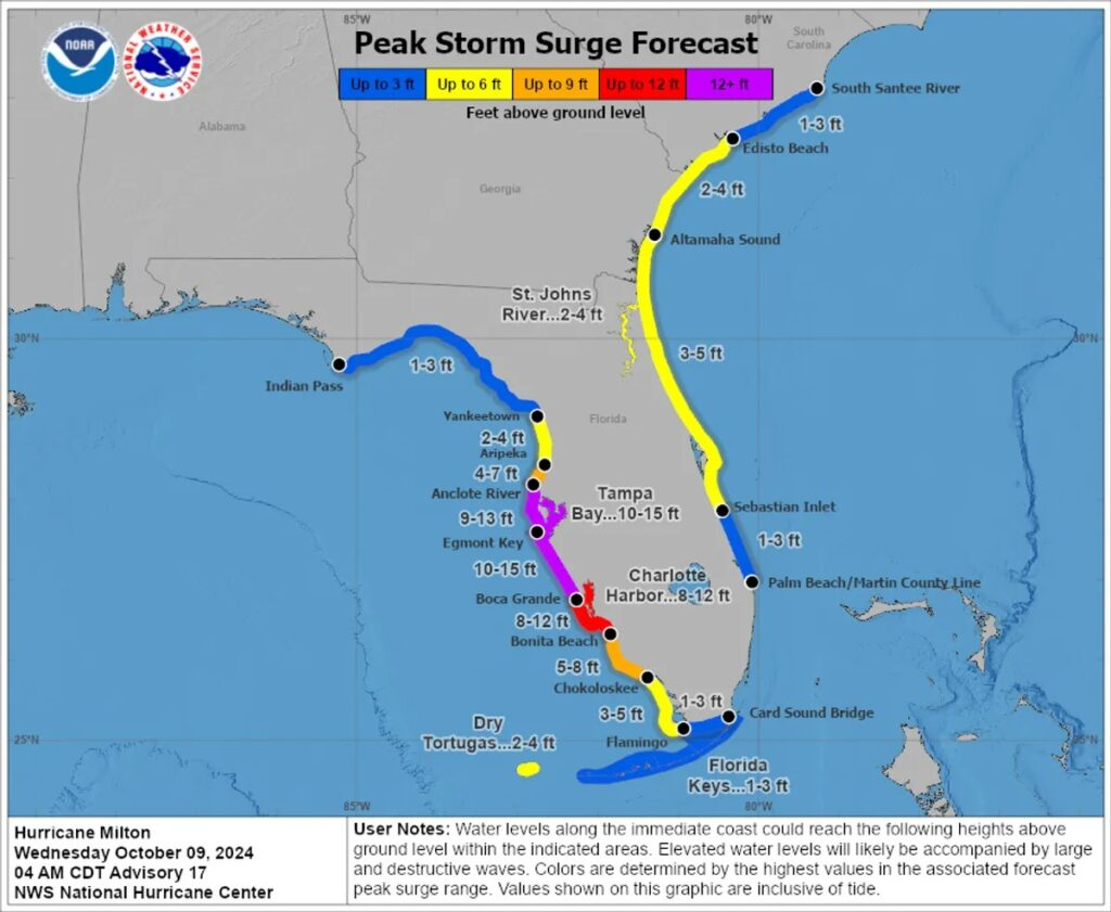
Along with powerful winds, water will be a huge issue. Dramatic pressure changes over the sea are set to cause an abnormal rise in sea levels that will flood the land, known as a storm surge.
Storm surges of up to 4.5 meters (15 feet) could strike the Tampa Bay area, Egmont Key, and Boca Grande. Much of the coast of the Florida Peninsula will be hit with some degree of storm surges, from the Florida Keys in the south to Indiana Pass in the northwest and Altamaha Sound in the northeast.
Heavy rain from Tuesday through Wednesday night will also become a serious peril, causing flash flooding as well as major river flooding.

Make no mistake: this will be a catastrophic storm. Tampa Mayor Jane Castor told CNN on Monday evening: “I can say without any dramatization whatsoever: If you choose to stay in one of those evacuation areas, you’re going to die.”
Mayor Castor issued Executive Order 2024-5 on Sunday, declaring a state of emergency due to Hurricane Milton. She’s called on all residents in Tampa Bay to evacuate the area before the storm strikes, including some mandatory evacuation orders for people in Hillsborough County and those living in mobile homes.
Florida was among the states struck by Hurricane Helene a couple of weeks ago in late September, killing at least 227 people. Hurricane Milton will be a very different storm to Helene and direct comparisons are unwise, but power outages, widespread damage to property, and loss of life are not to be unexpected.

Milton’s extreme wind speeds and forecasted storm surge could make it one of the most dangerous to approach Florida in recent memory, comparable to past destructive storms like Hurricane Andrew (1992), Katrina (2005), and Irma (2017).
Colossal storms like these are forecasted to become more common – and perhaps even more damaging – in years ahead due to climate change. Warmer sea surface temperatures provide more energy for hurricanes, potentially leading to increased intensity and faster wind speeds. Simultaneously, climate change may slow down the movement of hurricanes as they drift across geographical regions. This allows the hurricane to lurk over one area for longer, thereby increasing the amount of damage it can inflict.

Leave a Reply