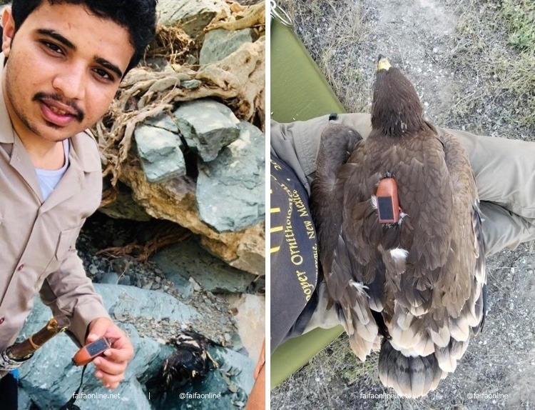
A young Saudi man named Fahd Qash made an interesting discovery while out for a stroll. He came upon a dead eagle with a tracking device while strolling by a marsh. Qash was intrigued to see an email address printed on the GPS tracker. It transpires that the instrument was attached to the eagle in Kazakhstan as a part of a study of Steppe eagle flight paths.
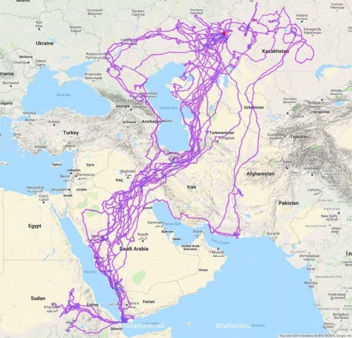
The map of their journeys produced by tracking 20 eagles since 2018 includes this particular one, and it is astounding. The Caspian Sea, Red Sea, and Persian Gulf are all devoid of their traces, which is intriguing because they all seem to deliberately avoid flying over bodies of water. Some media outlets initially reported that the flight path was for one eagle over the course of 20 years due to earlier errors in translation, but experts have pointed out that this would be virtually impossible. One is that the OrniTrack device the eagle is wearing was not accessible 20 years ago, not to mention the battery life was inadequate.

Despite this initial misunderstanding of the study, the map nevertheless contains a lot of useful information. One thing it seems to suggest is that the eagles’ winter migration follows a well-defined aerial route. There wouldn’t be a need to fly over the ocean to rehydrate because, as one commenter noted, there would be plenty of drinking water available on the steppes.
The fact that some trails appear to abruptly end suggests that some of the eagles—like the one that was discovered—died and ceased to exist. An eagle can travel up to 220 miles (355 km) in a single day, according to a 2012 study by the organization British Birds, and they are constantly moving between migration, breeding, and wintering.
When the owner of a dead eagle with a GPS tracker was contacted, the information was quite interesting. The eagle was discovered in Saudi Arabia.

This map shows the migration routes of 20 eagles that were tracked over the course of one year.

h/t: [Bored Panda]

Leave a Reply