
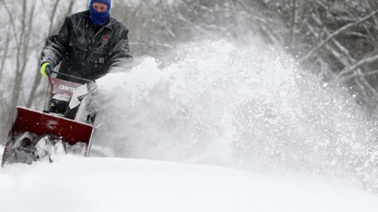
A powerful and widespread winter storm is set to impact large portions of the South, Midwest, and Northeast from Friday through Monday, bringing dangerous ice accumulation and heavy snowfall to millions across the United States.
The Weather Channel has officially named the system Winter Storm Fern, and forecasters warn it could affect more than 180 million people — over half of the U.S. population — stretching from New Mexico and Texas to parts of New England.
Winter Storm Alerts Issued Across Multiple States
Winter storm watches have already been issued from New Mexico through parts of the Southeast, with warnings expected to expand as the storm intensifies.
Forecasters caution that the most severe impacts will occur in areas eventually placed under winter storm warnings and ice storm warnings, urging residents to closely monitor official alerts and timing updates through trusted weather sources.
Storm Timeline and Impacted Cities
Friday
Snow, sleet, and freezing rain will intensify by late morning or early afternoon across the Plains, including parts of Kansas, Oklahoma, northern and western Texas, and extending into Arkansas, western Tennessee, and northern Mississippi.
Cities at risk:
Lubbock, Oklahoma City, Tulsa, Little Rock
Friday Night
Wintry precipitation will push farther south across the Southern Plains and lower Mississippi Valley, while spreading east into the Tennessee Valley, Appalachians, and parts of Virginia and the Carolinas.
Cities impacted:
Albuquerque, Oklahoma City, Tulsa, Dallas, Austin, Little Rock, Shreveport, Memphis, Nashville, Huntsville, Asheville
Saturday
Snow and ice may extend even farther south into Texas, Louisiana, and Mississippi, while intensifying across Kentucky, Tennessee, West Virginia, Virginia, and the Carolinas.
Cities impacted:
Albuquerque, Lubbock, Oklahoma City, Dallas, Austin, San Antonio (possible), Little Rock, Shreveport, Memphis, Nashville, Knoxville, Asheville, Charlotte, Raleigh, Roanoke, Richmond
Saturday Night
The storm may sag south toward southeast Texas, southwestern Louisiana, central Mississippi, and parts of Georgia and South Carolina. Meanwhile, snow could intensify across the Mid-Atlantic and Northeast, while continuing across the Ozarks and Mid-Mississippi Valley.
Cities impacted:
Houston, Dallas, Oklahoma City, Tulsa, Little Rock, Shreveport, Jackson, Memphis, Nashville, Knoxville, Charlotte, Greenville-Spartanburg, Columbia, Richmond, Washington D.C., Baltimore, Pittsburgh, Philadelphia, New York City
Sunday into Monday
Wintry precipitation will taper off across Texas, Oklahoma, and the lower Mississippi Valley by midday Sunday, but will persist from the Ohio Valley through the Carolinas and into the Northeast.
Heavy snow remains possible in parts of the Ohio Valley and Northeast, with lingering snow and wind continuing into early Monday.
Cities impacted:
Louisville, Cincinnati, Cleveland, Atlanta (northeast metro), Charlotte, Raleigh, Richmond, Washington D.C., Baltimore, Pittsburgh, Philadelphia, New York City, Boston
Ice Threat: Power Outages Likely
Significant ice accumulation is forecast across a broad swath of the South, from Texas to the Carolinas.
Ice buildup may:
- Make roads hazardous or impassable
- Accumulate on trees and power lines
- Cause tree damage and widespread power outages
Officials warn outages could last hours or even several days, especially as colder Arctic air pours in behind the storm.
Snowfall Potential and Travel Disruptions
While snowfall totals are still being refined, forecasters expect a wide zone of heavy snow from New Mexico, northern Texas, and Oklahoma eastward.
The risk is increasing along the I-95 corridor, including Washington D.C., Philadelphia, New York City, and parts of southern New England.
Hazardous travel, road closures, and major flight delays or cancellations are likely, especially Sunday and early Monday at major East Coast airports.
Dangerous Cold Follows the Storm
Compounding the storm’s impacts will be a surge of Arctic air, threatening daily cold records across parts of the South, Midwest, and East.
- Daytime highs may remain below freezing into Monday or Tuesday
- Overnight lows could drop into the single digits, teens, and 20s
- Refreezing will create slippery roads even after snowfall ends
Those without power could face dangerously cold conditions for days.
Why This Storm Is So Widespread
Meteorologists cite a “perfect setup”:
- A strong Arctic high pressure system settling over the Great Lakes, pushing cold air deep into the South
- A storm system emerging from the Southwest, drawing moisture northward
The clash of cold air and moisture creates ideal conditions for snow, sleet, and freezing rain across a massive region.
Severe winter storms have significant economic and infrastructure impacts, affecting transportation networks, energy systems, insurance claims, and emergency response planning. As extreme weather events become more frequent, households, businesses, and municipalities are increasingly focused on weather risk management, power outage preparedness, property protection, and emergency insurance coverage to reduce long-term financial and safety risks.
Leave a Reply