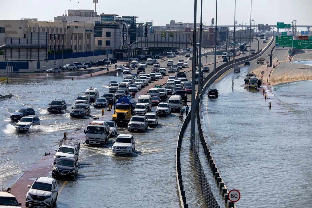
Unprecedented and torrential rainfall engulfed parts of the United Arab Emirates last week, plunging cities like Dubai into chaos and bringing life to a standstill. The aftermath of the UAE’s largest deluge on record was so profound that even days after the clouds dispersed and the rain ceased, satellites continued to capture the extent of the flooding from space.
A deluge of heavy rain inundated vast swathes of the UAE from late Tuesday, April 16, through Wednesday, April 17, with Dubai experiencing a year’s worth of rainfall in just 12 hours. In areas further east, nearly two years’ worth of rain fell within a mere 24 hours.
The brunt of the downpour targeted regions north and east of the country’s capital, Abu Dhabi, where rainfall totals ranged from 4 to 8 inches (approximately 100 to 200 mm), with some areas receiving nearly 10 inches (250 mm) of rainfall.

As floodwaters surged, they lingered stubbornly, slow to recede in the wake of the historic deluge, which marked the most extreme weather event in the country’s recorded history spanning 75 years.
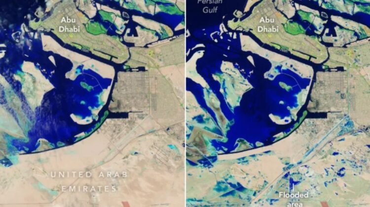
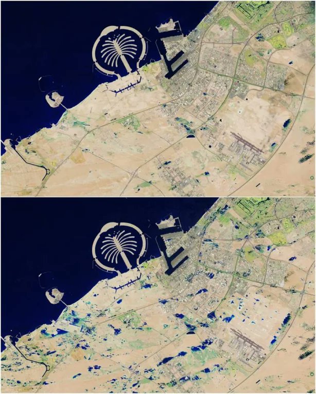
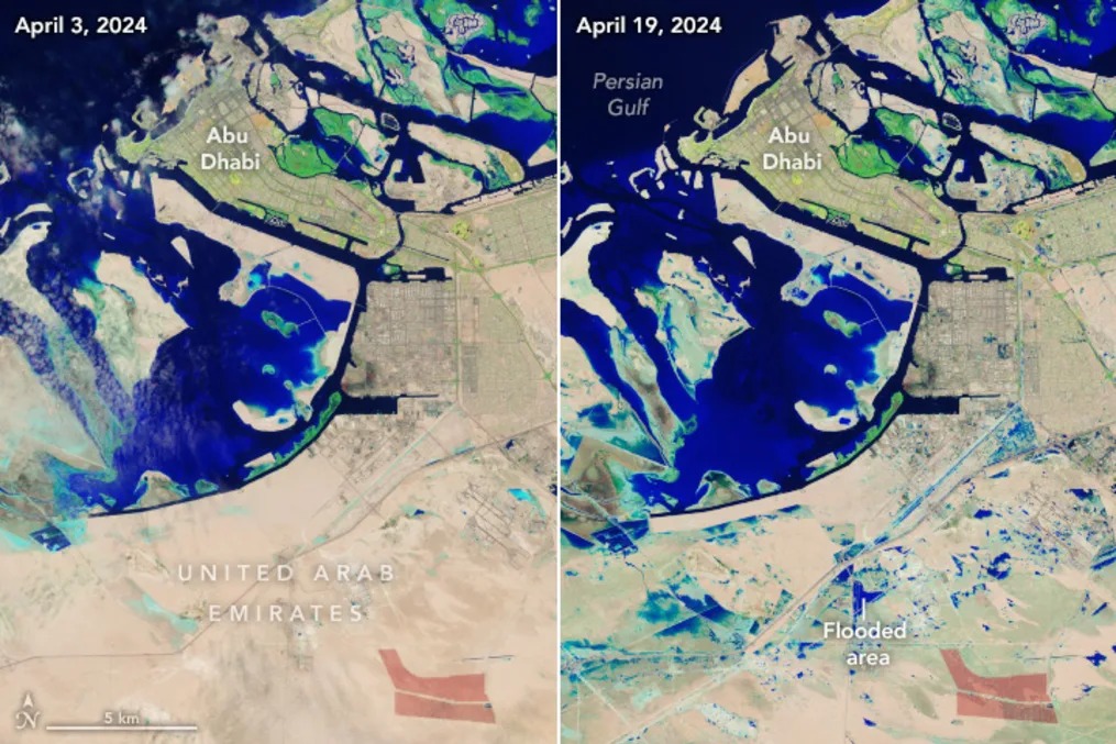
Less than 48 hours after the rains subsided, the Landsat 9 satellite passed over the UAE on Friday, April 19, capturing striking images of vast pools of floodwater. Operated jointly by NASA and the United States Geological Survey, Landsat 9 provides detailed imagery of Earth’s surface.
The images reveal large expanses of deep blue, indicative of floodwaters juxtaposed against the typically arid landscape of Dubai, which appears tan or light brown. Notably, the images focus on the southernmost part of Dubai, with the bustling urban core of the city not fully captured.

NASA
To enhance the visibility of water bodies, Landsat 9 utilizes false color products, highlighting differences in land features. While not an exact representation of how the scene would appear to the human eye, these images facilitate the identification of flooded areas against dry terrain.
Additionally, significant flooding is observed in Abu Dhabi, where small, shallow water bodies appear light blue, while larger, deeper pools of floodwater are depicted in dark blue.
The aftermath of the deluge is further underscored by a light green tint that envelops large sections of dry land, indicative of residual moisture retained from the rainfall, even in areas that did not experience full flooding.

Although these satellite images may not capture the full extent of the flooding, they offer a poignant glimpse into the aftermath of the stormy weather that swept across the region.
The torrential rainfall, part of a larger storm system traversing the Arabian Peninsula and the Gulf of Oman, also inflicted deadly flooding in neighboring Oman. Such extreme weather events are increasingly linked to human-induced climate change, with a warmer atmosphere capable of holding more moisture and unleashing intense rainfall upon unprepared regions lacking adequate infrastructure to mitigate flooding risks.

Leave a Reply