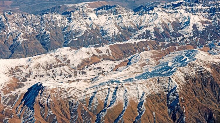
Deep under the country’s southeast, a slab of Earth’s outer shell is splitting in two places at once, and geologists say the rifts may one day join.
On the scale of a human life, the plates that make up Earth’s crust and upper mantle barely seem to move at all. Yet they never stop, and over millions of years their slow collisions raise mountains, close oceans and redraw the map of the continents. Now a team of researchers led by the Chinese Academy of Sciences has found a rare glimpse of that process at work: two giant tears in the Arabian Plate, hidden far beneath southeastern Iran.
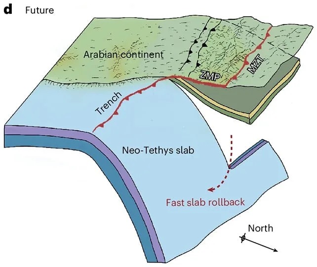
The explanation lies in the plate itself, which is made of two very different kinds of rock. One part is an oceanic slab, a remnant of the ancient Neo-Tethys Ocean. Its basalt is thin and heavy, and it is being pushed down beneath a neighboring plate in a process known as subduction. The other part is continental, thicker but lighter, built from granite-like material. Rock of this kind resists being forced underground and tends to crumple upward into mountains instead. Pull a single plate in two such directions and, eventually, something has to give.
A Secret Written in Seismic Waves
The researchers, whose findings appear in Nature Geoscience, did not drill or dig to find the damage. Instead they listened. A network of 69 seismic stations recorded vibrations from distant earthquakes over about a year and a half. Because those waves speed up or slow down depending on the temperature and density of the rock they pass through, the readings could be assembled into an image of the plate’s interior, in much the same way a scan reveals what lies beneath the skin.
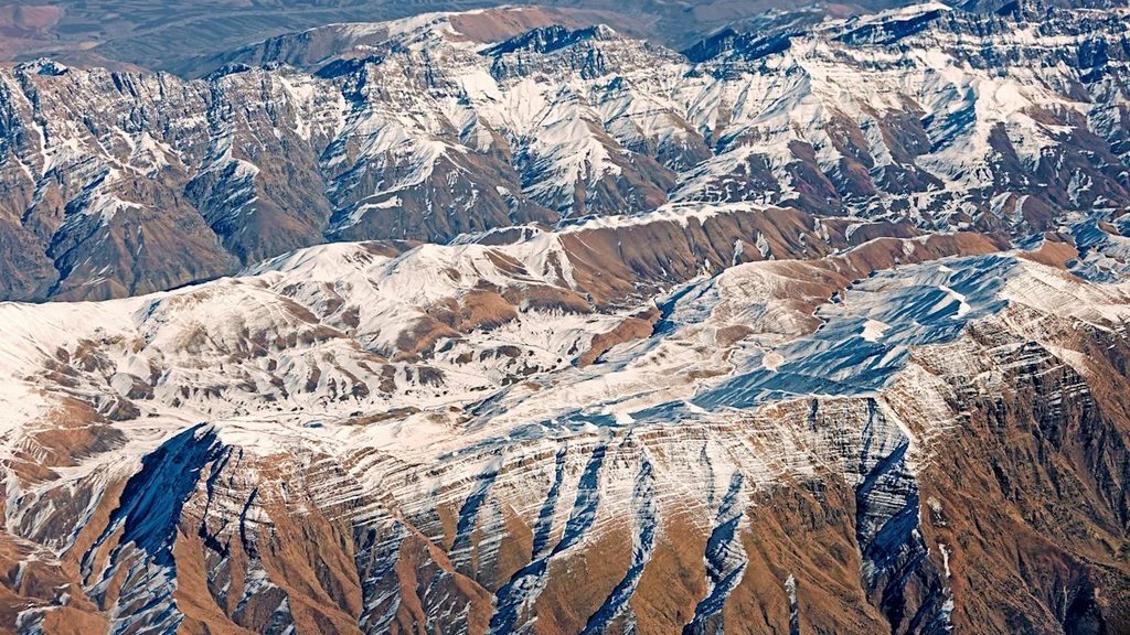
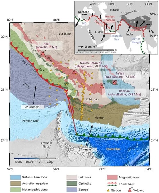
The picture that emerged shows two distinct ruptures, in a region where the Makran subduction zone meets the Zagros collision zone. The larger is a horizontal tear at the junction of the two. In Makran, where the Arabian Plate slides northward beneath Eurasia, the oceanic slab has kept sinking to depths of at least 450 kilometers. To the west, in the Zagros, the continental slab has gone down no deeper than about 300 kilometers. That mismatch in how far each side has descended has pulled the slab apart and caused part of it to detach.
The second tear is smaller, vertical and closer to the surface, near the Makran Trench. The team believes it probably began at the junction between the trench and a transform boundary, and has been spreading southward as the continental plate pushes north. Unlike the first, it owes more to the motion of the plates than to the difference between oceanic and continental rock. Either kind of tear is known to geologists; seeing both together, in the same place, is highly unusual.
That is what makes the discovery so valuable. In their paper, the authors describe it as a rare snapshot of the short-lived early transition from oceanic subduction to continental collision. This stage is a key part of what is known as the Wilson Cycle, the long sequence in which oceans open, widen and finally vanish as plates drift together. Scientists have struggled to understand it in detail, largely because structures this deep are so hard to observe. Here, they are watching the last chapter of the Neo-Tethys Ocean being written. Other research has described the same ancient ocean floor tearing farther west, beneath the Zagros mountains, suggesting this is part of a larger, ongoing story.
What Happens When the Two Tears Meet?
The story does not end there. The team’s models suggest the tears have been growing for several million years, and that they are likely to meet. The two ruptures start independently, but the strip of boundary between the continental and oceanic rock is gradually consumed as tearing advances, and the researchers expect that slow linking to end with the tears merging. Humans will almost certainly be long gone by then, but geologists today have a front-row seat.
What happens next remains an open question, particularly for the region’s volcanoes. There are already hints that hot magma is seeping into some of the gaps the tears have opened, and the researchers say the next step is to work out how the ruptures, and their eventual union, might shape volcanic activity at the surface.
Work like this has practical value far beyond academic geology. The study does not link the tears to any particular earthquake, but the wider region sits on one of the planet’s most active plate boundaries, and sharper images of what lies beneath it help engineers, insurers and planners judge seismic and volcanic hazards more realistically. The same seismic-imaging methods are also central to the search for oil, gas and geothermal heat, which matters in a part of the world where the Zagros ranks among the great petroleum provinces. And the effort depends on dense sensor networks and powerful computer modelling, the kind of technology that is steadily making it possible to see deep into the planet. For now, the finding offers a vivid reminder that the ground beneath us, however still it feels, is the slow-moving surface of a restless planet.
Frequently Asked Questions
What did scientists discover beneath Iran? Two giant tears in the Arabian Plate, deep beneath southeastern Iran.
Who made the discovery? A research team led by the Chinese Academy of Sciences, with the results published in Nature Geoscience.
What is causing the tears? Mostly the difference between heavy, thin oceanic rock that sinks easily and lighter, thicker continental rock that resists sinking. The second tear is driven more by the movement of the plates.
What is subduction? It is the process in which one tectonic plate is pushed beneath another and sinks into the mantle.
How did researchers see so deep underground? They used 69 seismic stations to record vibrations from distant earthquakes. Changes in wave speed reveal the temperature and density of the rock, which lets scientists build an image of the plate.
How deep does the plate sink in this region? The oceanic slab in Makran has sunk to at least 450 kilometers, while the continental slab in the Zagros has gone no deeper than about 300 kilometers.
Will the two tears join? Computer models suggest they very likely will, though not for a very long time.
Do the tears cause earthquakes? The study does not claim that. Scientists want to understand how deep processes like these shape earthquakes and volcanic activity at the surface, which is still an open question.
Why does this matter for people living in the region? Better images of the deep structure help engineers, insurers and planners assess seismic and volcanic hazards, and the same technology supports energy exploration.
What is the Wilson Cycle? The long process in which oceans form, widen and eventually disappear as tectonic plates move.
What was the Neo-Tethys Ocean? An ancient ocean whose last remnants are being consumed as plates converge in this region.
Could the tears affect volcanoes? Scientists are asking exactly that, and hot magma already appears to be filling some of the gaps.
Sources: Lan, Guo, Sun and colleagues, Nature Geoscience; Live Science.
Leave a Reply