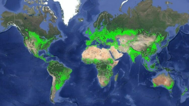
Map of the world’s cropland
A new high-resolution map shows croplands worldwide, highlighting India as having the highest net cropland area. South Asia and Europe are also recognized as agricultural capitals of the world.
Released by the U.S. Geological Survey (USGS) on Tuesday, this map offers the most detailed view of global croplands yet, which is crucial for ensuring global food and water security sustainably. The map identifies 1.87 billion hectares of croplands worldwide, a figure 15-20% higher than previous estimates, amounting to an increase of 250-350 million hectares. This adjustment stems from a more detailed understanding of areas previously unmapped or misclassified as non-cropland, explained the USGS.
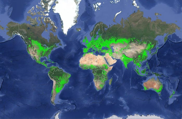
Previous studies identified China or the U.S. as having the largest net cropland areas. However, this latest research places India at the top with 179.8 million hectares (Mha), representing 9.6% of global cropland. The U.S. follows with 167.8 Mha (8.9%), China with 165.2 Mha (8.8%), and Russia with 155.8 Mha (8.3%). Detailed statistics for each country can be explored in an interactive map on the USGS website.
South Asia and Europe emerge as agricultural capitals due to their high cropland-to-geographic area ratios. Over 80% of Moldova, San Marino, and Hungary is cropland, followed by 70-80% in Denmark, Ukraine, Ireland, and Bangladesh, and 60-70% in the Netherlands, U.K., Spain, Lithuania, Poland, Gaza Strip, Czech Republic, Italy, and India. For context, croplands make up 18% of both the U.S. and China.
Led by the USGS, this study is part of the Global Food Security-Support Analysis Data @ 30-m (GFSAD30) Project. Utilizing Landsat satellite imagery with 30 m resolution, USGS claims this map offers the highest spatial resolution of any global agricultural dataset.
Importance of Detailed Cropland Monitoring
“The map clearly shows individual farm fields, big or small, at any location in the world,” stated Prasad Thenkabail, USGS research geographer and principal investigator for the GFSAD30 Project. “With a resolution of 30 m and 0.09 hectares per pixel, we can see croplands in any country and sub-national regions, including states, provinces, districts, counties, and villages.”
As the global population approaches 7.6 billion and is expected to reach 10 billion by 2050, detailed agricultural monitoring becomes increasingly important, the USGS noted. This research benefits international development organizations, farmers, decision-makers, scientists, and national security professionals.
“This map serves as a baseline for higher-level assessments, such as identifying crop types, growth periods, productivity, fallow lands, and water sources,” Thenkabail explained. “Comparisons can be made between present and past years, as well as between farms, aiding in informed and productive farm management.”
The map and its data are vital for food security and serve as a baseline for assessing water security. Nearly 80% of human water use is dedicated to food production, and this research provides insights into “crop per drop,” evaluating the amount of crops produced per unit of water.
Research is a ‘Major Undertaking’
“The project is a major undertaking for several reasons,” Thenkabail said. “One significant challenge was obtaining cloud-free images in regions such as the tropics and during rainy seasons, which took multiple years in some areas. This project required satellite-acquired ‘big data’ analytics using machine-learning algorithms on platforms like Google Earth Engine.”
The map underwent rigorous validation, achieving an overall accuracy of 92%, validated by an independent team across 72 global zones.
USGS led the project, providing Landsat imagery. They acquire, process, archive, and freely distribute Landsat data from 1972 to the present. This project used a unique dataset primarily from Landsat satellite imagery from 2015. Remote sensing is crucial for obtaining a global perspective and objective, unbiased information, noted the USGS.
Leave a Reply