Scroll social media long enough and you’ll run into landscapes that look almost too strange to be real — and increasingly, some of them aren’t. AI-generated images are mixing into people’s feeds alongside genuine photography more than ever. But Earth still has plenty of real places that are every bit as improbable-looking, no generative model required.
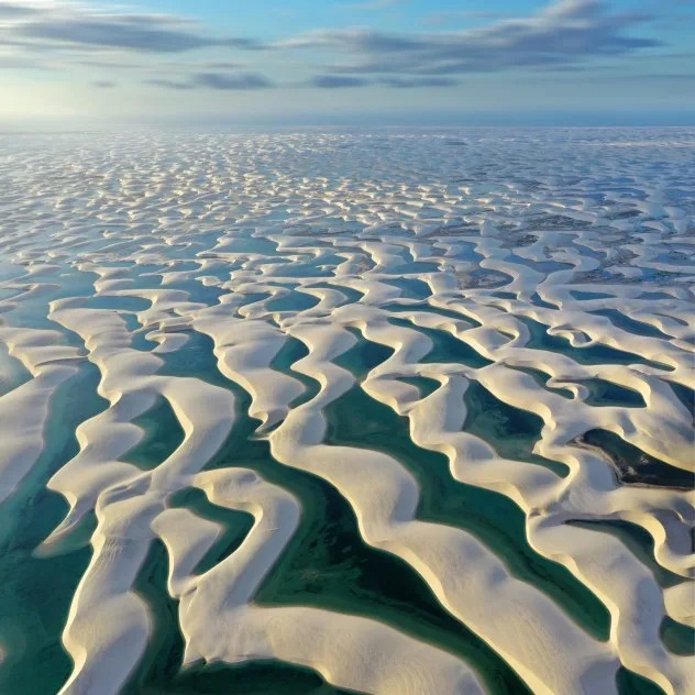
Lençóis Maranhenses, Brazil: A Desert Covered in Lakes
From above, Lençóis Maranhenses National Park looks like an endless field of white sand dunes — a desert, in other words. But during the rainy season, rainwater collects in the valleys between dunes, filling the landscape with hundreds of temporary turquoise and green lagoons. The dunes span roughly 90,000 hectares along Brazil’s northeastern coast, constantly reshaped by wind and rain. According to UNESCO, the lakebeds are coated in a layer of brown or green algae and cyanobacteria, which contributes to “a landscape of unique beauty rarely found anywhere else in the world.”
Kawah Ijen, Indonesia: The Volcano With “Blue Lava”
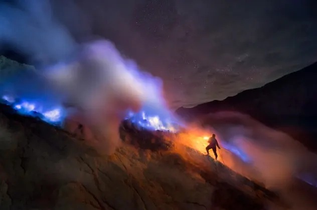
At night, Indonesia’s Kawah Ijen volcano appears to leak streams of electric-blue fire across its rocky slopes. It isn’t actually lava — sulfur-rich gases escaping through cracks near the crater ignite on contact with oxygen, producing brilliant blue flames visible mainly in darkness. The volcano also holds a striking turquoise crater lake, ringed by sulfur deposits, adding a second layer of unlikely color to an already surreal setting.
Horizontal Falls, Australia: A Waterfall Turned Sideways
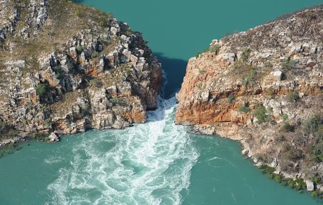
Rather than water falling over a cliff, Australia’s Horizontal Falls — known to local Indigenous people as Garaanngaddim — forces seawater sideways through narrow gaps in the McLarty Range, in Western Australia’s remote Kimberley region, driven by some of the largest tidal swings on Earth. As Western Australia’s Department of Primary Industries and Regional Development describes it: “Twice daily, millions of litres of seawater cascade, hurtle and tumble from one bay to another… through narrow gaps between two sets of orange sandstone massifs.” The two main gaps measure roughly 79 feet and 20 feet wide, and water levels on either side can differ by as much as 13 feet as the tide reverses direction.
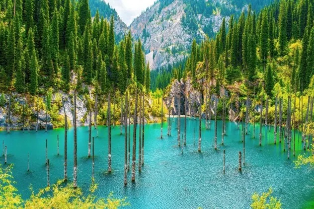
Lake Kaindy, Kazakhstan: A Ghost Forest Rising From Turquoise Water
Bare tree trunks jut straight up out of Lake Kaindy’s blue-green water, giving it the look of a flooded, drowned forest — which, essentially, it is. In 1911, a major earthquake triggered a landslide in Kazakhstan’s Tian Shan Mountains, damming a river and flooding the forested gorge behind it. More than a century later, the trunks are still standing, their preserved branches and needles visible beneath the surface in the cold, oxygen-poor water.
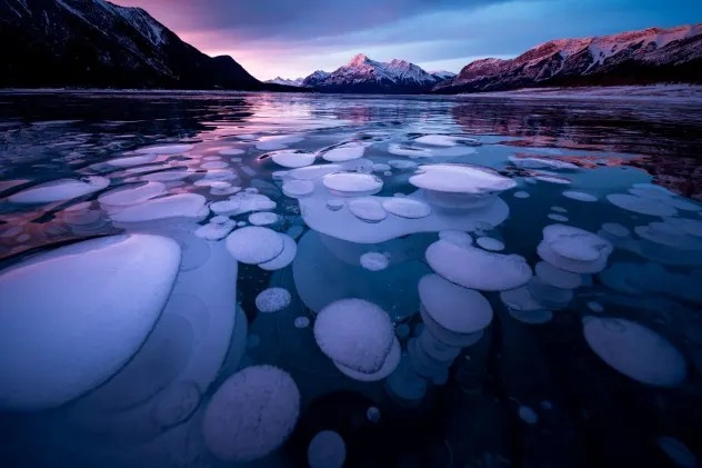
Abraham Lake, Canada: Bubbles Frozen Mid-Rise
In deep winter, Alberta’s Abraham Lake fills with stacked white bubbles that appear frozen in place just beneath the ice’s surface. The bubbles are methane, released as bacteria break down organic plant material at the bottom of this human-made reservoir. As the gas rises during cold enough weather, successive layers of forming ice trap it before it can reach the surface — creating patterns that can resemble anything from stacked pancakes to jellyfish suspended in glass.
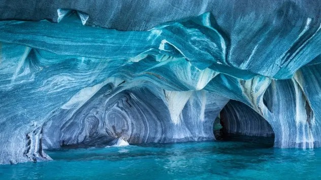
Marble Caves, Chile: A Cathedral Carved by Water
Along General Carrera Lake in Chilean Patagonia, thousands of years of water erosion have carved sweeping arches, columns, and caverns directly into solid marble. Light reflecting off the lake washes the cave walls in shifting shades of blue and turquoise that change with water level and time of day. General Carrera Lake itself covers about 1,850 square kilometers, making it Chile’s largest lake, with formations like the Marble Cathedral and Marble Chapel among its most visually striking features.
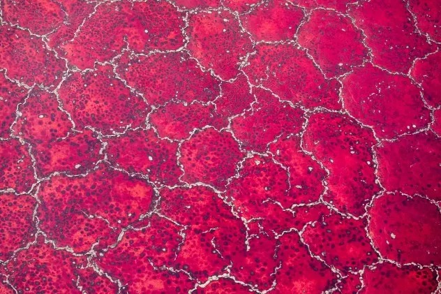
Lake Natron, Tanzania: Africa’s Blood-Red Lake
In Tanzania’s Great Rift Valley, Lake Natron can turn deep shades of red and pink as water evaporates and its salinity climbs. The color comes from halophilic (salt-loving) microorganisms, including cyanobacteria, that thrive as conditions become more extreme — the lake’s pH can exceed 12, and shallow-water temperatures can reach 60°C (140°F).
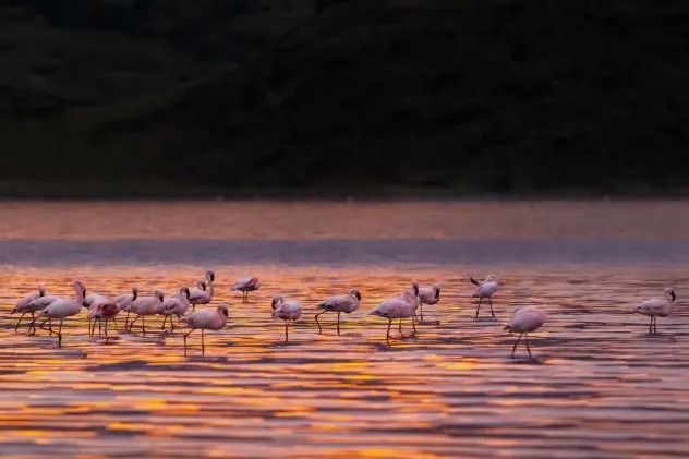
That harsh chemistry makes the lake nearly uninhabitable for most animals, and, according to Smithsonian Magazine, unlucky birds and bats that fall into the water are sometimes calcified in place by the lake’s sodium carbonate deposits — the same compound used historically in Egyptian mummification — preserved in the exact pose in which they died. Yet that same inhospitable environment makes Lake Natron essential habitat: it’s the only regular breeding site in East Africa for roughly 2.5 million lesser flamingos, whose thick, salt-resistant leg skin and specialized filtering bills let them thrive precisely where almost nothing else can survive.
Frequently Asked Questions
Are any of these places dangerous to visit? Some require real caution — Lake Natron’s water can burn skin and shouldn’t be entered, and Kawah Ijen’s sulfur gases pose genuine respiratory risks, so visits to the more extreme locations on this list are best done with an experienced local guide.
How can you tell if a striking landscape photo online is real or AI-generated? Checking whether the location is documented by a reputable source like UNESCO, a national park service, or established travel and science publications is generally more reliable than trying to spot visual “tells,” since AI image quality has improved enough to fool a casual glance.
Why do so many of these unusual landscapes involve water and minerals specifically? Water is an extremely effective agent of both erosion (as with the Marble Caves) and mineral concentration (as with Lake Natron’s salts or Abraham Lake’s trapped methane), which is why so many of Earth’s most visually extreme natural landscapes form around it in one way or another.
Sources: UNESCO, Western Australia’s Department of Primary Industries and Regional Development, and Smithsonian Magazine, cited above.
Leave a Reply