• Skip to main content
  • Skip to primary sidebar
  • Skip to footer
  • Home
  • About Us
  • Copyright Report
  • Submit Content
  • Terms
  • Privacy Policy
  • Legal Disclaimer

Hasan Jasim

Hasan Jasim is a place where you may get entertainment, viral videos, trending material, and breaking news. For a social generation, we are the largest community on the planet.

Some of the Best Images of Mars’ Surface Taken So Far

by Stephen King Leave a Comment

ShareTweet

Here are some of the best images taken on the Red Planet so far.

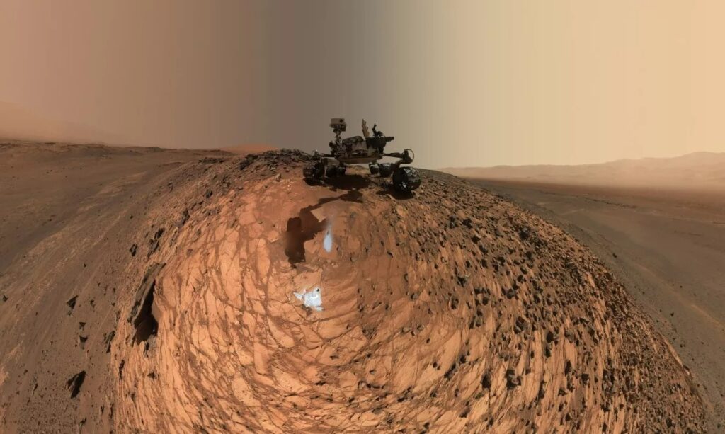
A low-angle self-portrait of NASA’s Curiosity Mars rover that shows the vehicle above the “Buckskin” rock target, where it collected its seventh drilled sample (click image to enlarge and zoom in). Image credit: NASA/JPL-Caltech/MSSS

As part of NASA’s Mars Exploration Program, a long-term effort of robotic exploration of the red planet, the Curiosity rover was designed to assess whether Mars ever had an environment able to support small life forms called microbes. In other words, its mission is to determine the planet’s “habitability.”

To find out, Curiosity carries the biggest, most advanced set of scientific instruments ever sent to the Martian surface. The rover analyzes samples taken from the planet’s soil and drilled from its rocks. The record of the planet’s climate and geology is essentially “written in the rocks and soil” — in their formation, structure, and chemical composition. Curiosity’s onboard laboratory studies the samples taken, as well as the local geologic setting, in order to detect chemical building blocks of life (e.g., forms of carbon) on Mars, assessing what the Martian environment was like in the past.

Part of that mission is taking photographs. A lot of them. And while for scientists they are all but maps to potential traces of life – which Curiosity has indeed found evidence of in rocks – for most of us they are a breathtaking opportunity to look around on the Red Planet. So here are some of the most interesting ones taken so far (click images to enlarge and zoom in).

This early 2017 look ahead from the Mastcam of NASA’s Curiosity Mars rover includes four geological layers to be examined by the mission, and higher reaches of Mount Sharp beyond the planned study area. “Vera Rubin Ridge” sits just above the reddish foreground rocks of the Murray formation. Image credit: NASA
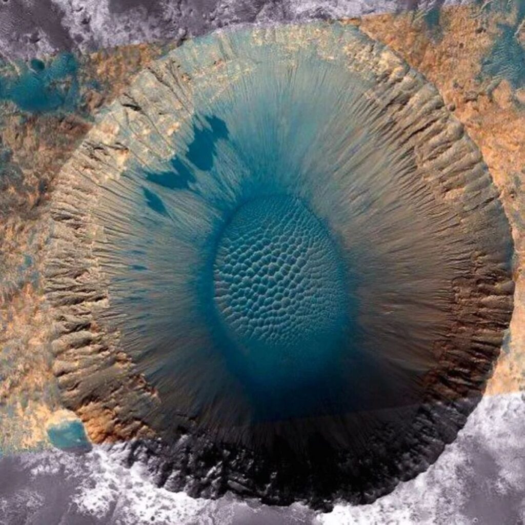
An astounding 1.5-km (almost a mile) diameter impact crater in Meridiani Planum on Mars. Image credit: NASA
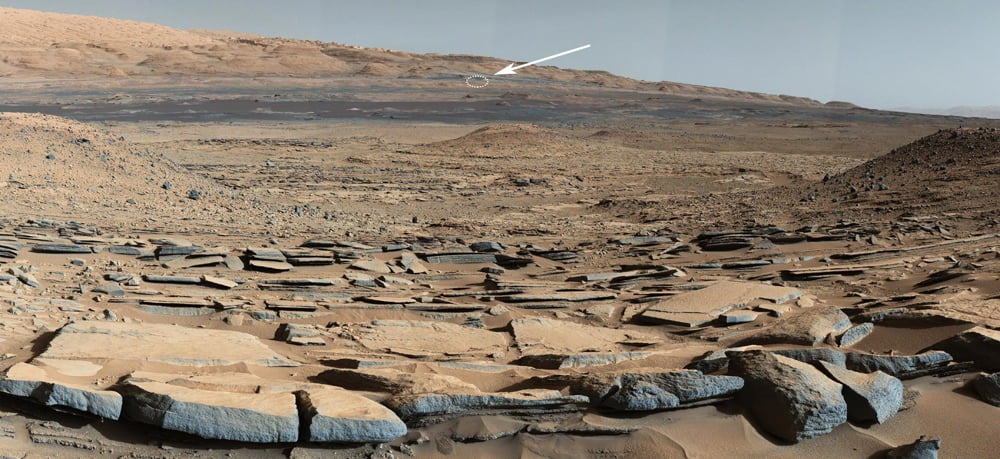
This image, taken back when NASA’s Curiosity rover was at the base of Mount Sharp on March 24, 2014, indicates the rover’s approximate location as of July 30, 2020 – about 3 1/2 miles away (about 5 1/2 kilometers). Image credit: NASA/JPL-Caltech/MSSS
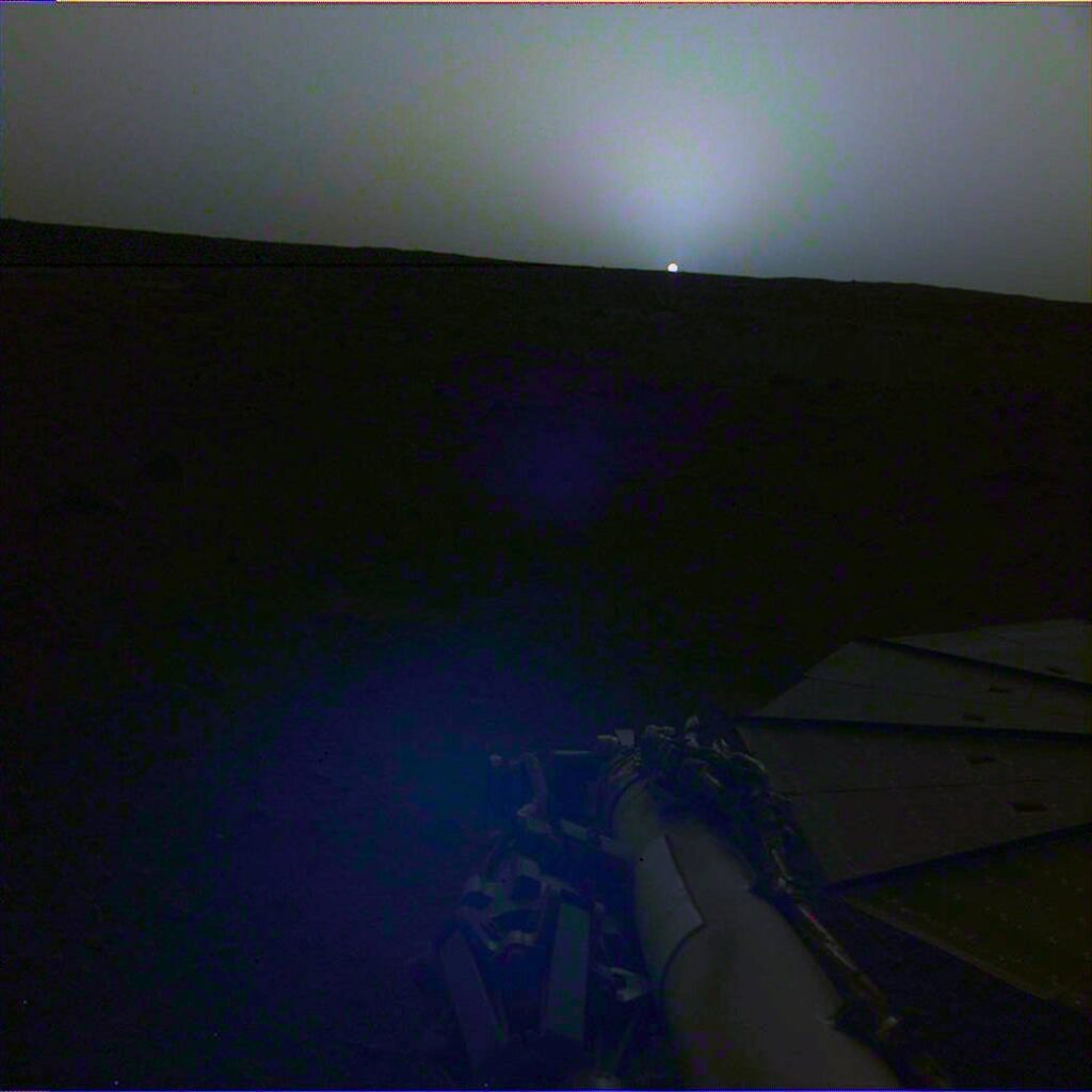
NASA’s InSight lander captures a sunset on Mars. Image credit: NASA
Curiosity Captures a Spaghetti Western Landscape on Mars: This wide panorama was taken by NASA’s Curiosity Mars rover on Dec. 19, 2019, the 2,620th Martian day, or sol, of the mission. On the righthand foreground is Western Butte; the ridge with a crusty cap in the background is the Greenheugh pediment, which Curiosity ascended in March, 2020. Image credit: NASA/JPL-Caltech/MSSS
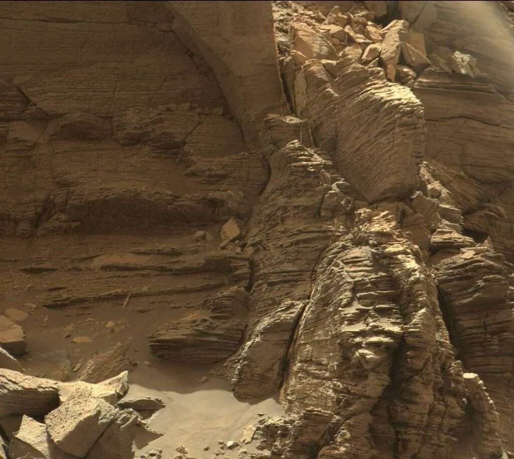
This view from the Mast Camera (Mastcam) in NASA’s Curiosity Mars rover shows an outcrop with finely layered rocks within the ‘Murray Buttes’ region on lower Mount Sharp. Image credit: NASA
Two sizes of wind-sculpted ripples are shown in this view of the top surface of a Martian sand dune. Sand dunes and the smaller type of ripples also exist on Earth. The larger ripples – roughly 10 feet (3 meters) apart – are a type not seen on Earth nor previously recognized as a distinct type on Mars. Image credit: NASA
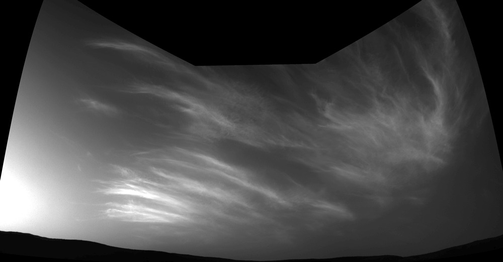
NASA’s Curiosity Mars rover imaged these drifting clouds on May 17, 2019, the 2,410th Martian day, or sol, of the mission, using its Navigation Cameras (Navcams). Image credit: NASA/JPL-Caltech.
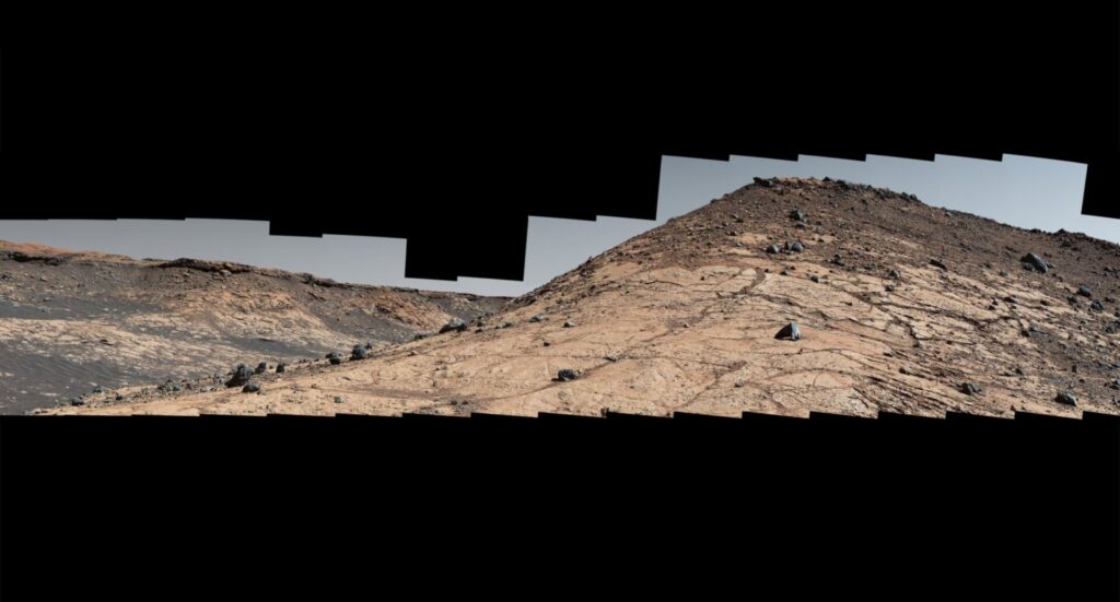
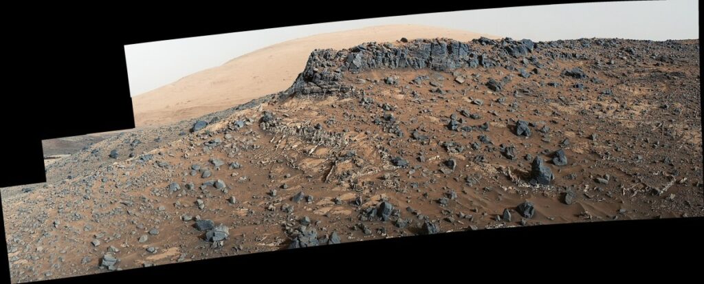
This March 27, 2015, view from the Mast Camera (Mastcam) on NASA’s Curiosity Mars rover shows a site with a network of prominent mineral veins below a cap rock ridge on lower Mount Sharp. Image credit: NASA/JPL-Caltech/MSSS
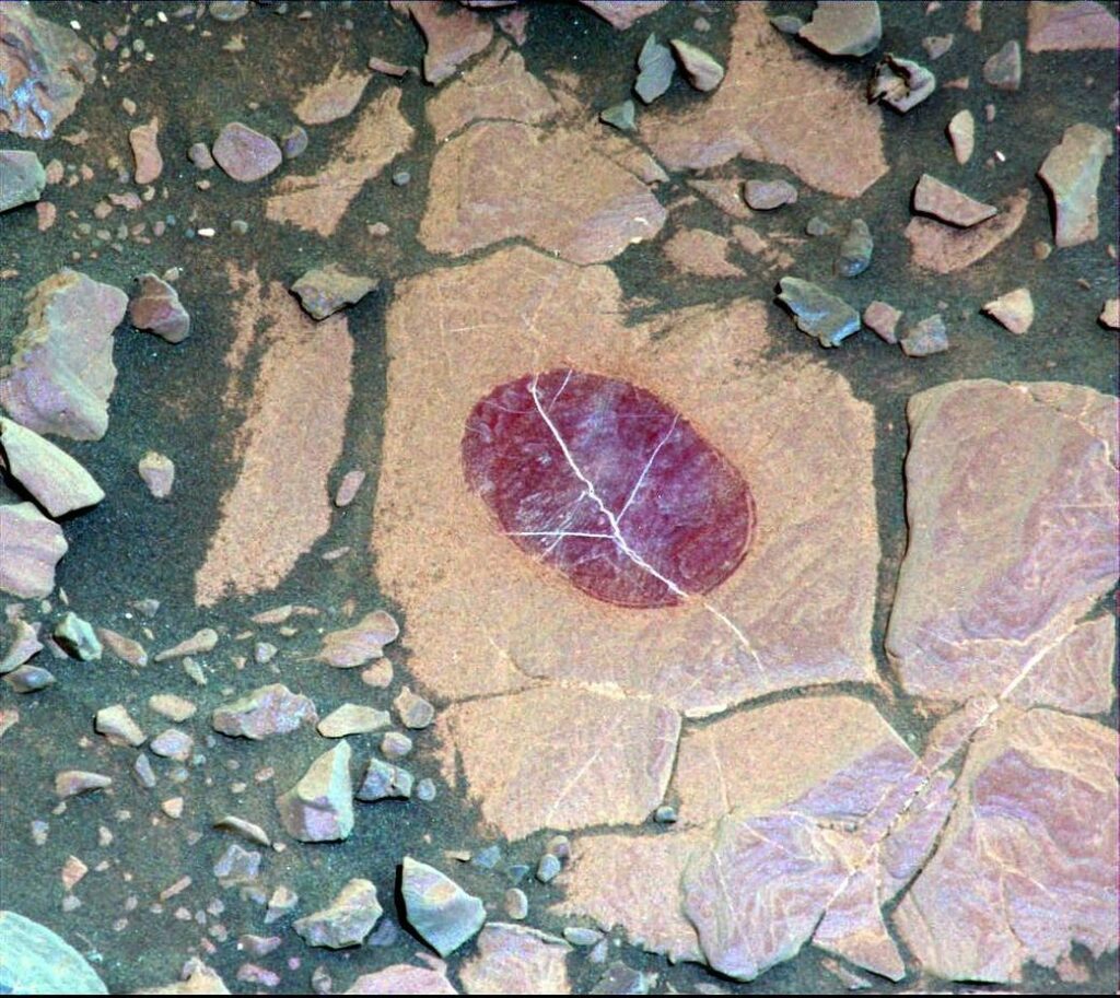
This false-color image demonstrates how use of special filters available on the Curiosity Mars rover’s Mast Camera (Mastcam) can reveal the presence of certain minerals in target rocks. Image credit: NASA
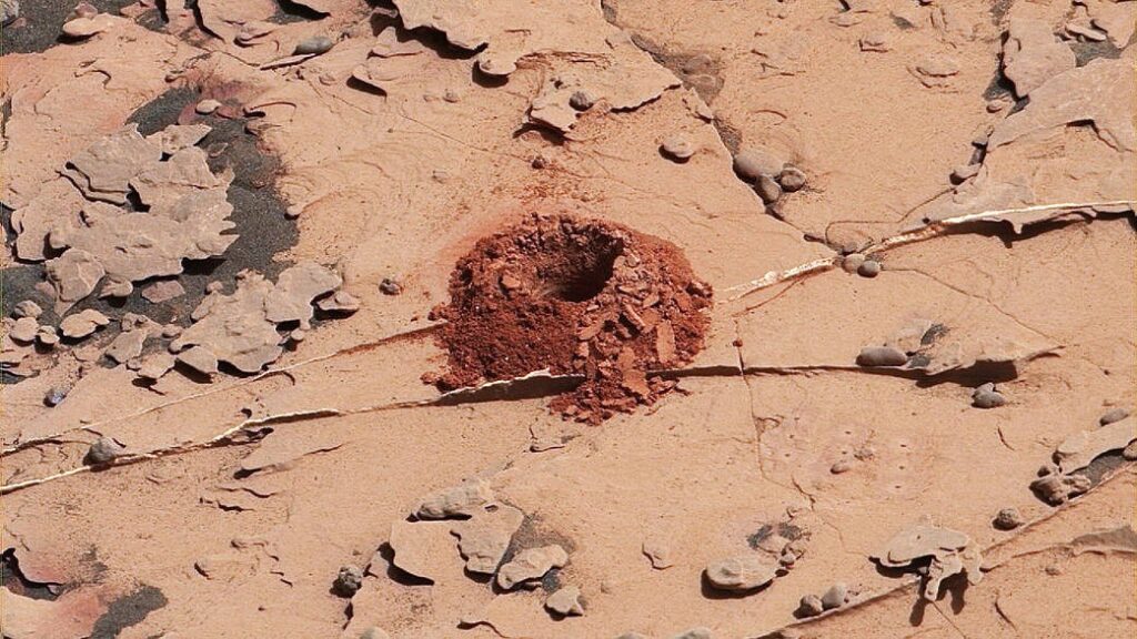
This close-up image is of a 2-inch-deep hole produced using a new drilling technique for NASA’s Curiosity rover. The hole is about 0.6 inches (1.6 centimeters) in diameter. This image was taken by Curiosity’s Mast Camera (Mastcam) on Sol 2057. Image credit: NASA
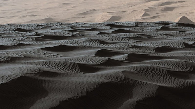
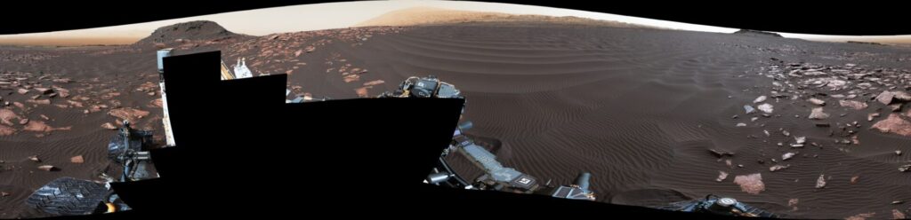
A rippled linear dune of dark Martian sand, “Nathan Bridges Dune,” dominates this full-circle panorama from the Mastcam of NASA’s Curiosity Mars rover. This particular dune was one research stop of the mission’s campaign to investigate active Martian dunes. Nathan Bridges (1966-2017) helped lead that campaign. Image credit: NASA

NASA’s Curiosity Project Scientist Ashwin Vasavada gives a descriptive tour of the Mars rover’s view in Gale Crater. Credit: NASA/JPL-Caltech.
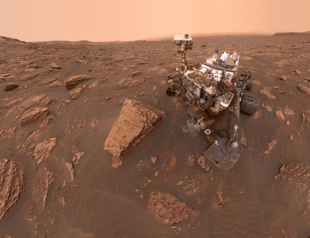
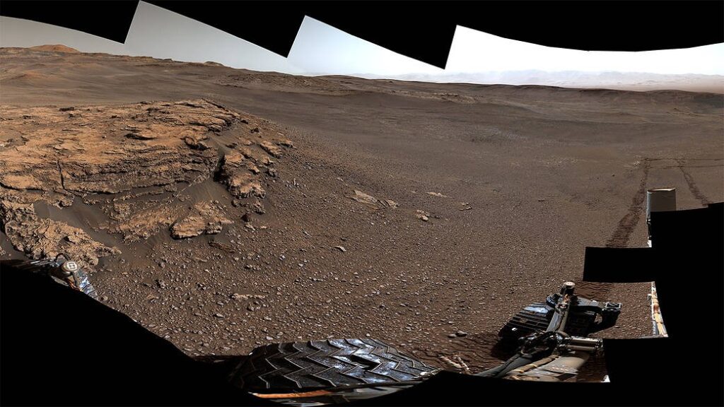
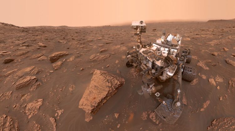
A self-portrait of NASA’s Curiosity Mars rover shows the robot at a drilled sample site called “Duluth” on the lower slopes of Mount Sharp on June 20, 2018. A Martian dust storm reduced sunlight and visibility in Gale Crater. The north-northeast wall and rim of the crater lie beyond the rover, their visibility obscured by atmospheric dust. Image credit: NASA/JPL-Caltech/MSSS
Position of Curiosity rover seven years after landing. It has traveled a total of 13 miles (21 kilometers) and ascended 1,207 feet (368 meters) to its current location. Image credit: NASA/JPL-Caltech/MSSS

Filed Under: Trends Worldwide Tagged With: best, images, mars, some, surface, taken, trends, worldwide

Reader Interactions

Leave a Reply Cancel reply

Your email address will not be published. Required fields are marked *

Primary Sidebar

More to See

Photographs Of A Rarely Seen Antarctica Flipped Iceberg

By Stephen King

What effects does climate change have on animals?

By Stephen King

They prevent the risk of Alzheimer’s disease, lower cholesterol, and help you lo.s.e w.e.ight.

By Stephen King

‘Spanish Stonehenge’ Revealed By Drought After 50 Years

By Stephen King

Pacific Palisades reservoir was offline and empty when firestorm exploded

By Stephen King

Terrified Rescue Poodle Gently Asking Baby for Pets Has People in Tears

By Stephen King

Amazing Heart-Shaped Amethyst Geode Found in Uruguay by Miners

By Stephen King

Footer

About hasanjasim.online

Hasanjasim.online is a digital platform dedicated to publishing diverse articles and content, with a strong focus on topics related to the animal kingdom, nature, and the environment. The website offers engaging stories and visual content aimed at raising awareness about animal welfare and showcasing the wonders of the natural world, making it a great destination for nature lovers and curious readers alike.

Recent

  • Tragic update on story of bear stuck on top of telephone pole
  • Royal Mail Worker Accused of Kicking Blind Dog Sparks Outrage as Fellow Postal Staff Defend His Actions
  • Photographer Travels 900 Miles to Capture One of the World’s Rarest Snowy Owls
  • Former Police Officer Accused of Poisoning Ex-Girlfriend’s Dog Faces Animal Cruelty Charge
  • Shameless Squirrel Keeps Making Himself At Home On Man’s Windowsill
  • Move over Jimothy: Dog with same short spine syndrome as raccoon melts hearts on internet
  • Homeless Dog Owner Sleeps Outside Veterinary Clinic to Save His Injured Companion

Search