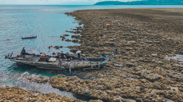
On the morning of June 8, 2026, a magnitude 7.8 earthquake struck offshore of southern Mindanao in the Philippines. Along parts of the coast, something unusual followed the shaking: the sea itself seemed to retreat, leaving stretches of seabed that had been submerged for generations sitting exposed in open air.
What Actually Happened to the Coastline
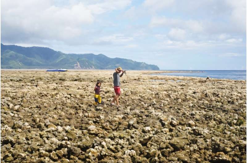
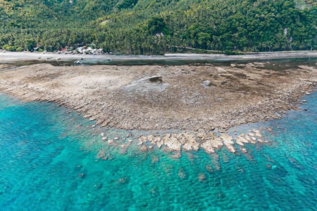
Scientists at the Philippine Institute of Volcanology and Seismology (PHIVOLCS) conducted an aerial survey three days after the quake and confirmed what residents had already noticed on the ground: the coastline in parts of Sarangani and Davao Occidental had physically risen. Along roughly 100 kilometers of shoreline — concentrated around the towns of Glan in Sarangani and Jose Abad Santos in Davao Occidental — the land lifted by as much as 2 meters (6.6 feet) and the shoreline pushed seaward by up to 200 meters (660 feet). In Barangay Pangyan in Glan, coral formations that had sat underwater for as long as anyone could remember were suddenly visible above the tideline.
PHIVOLCS attributed the shift to movement along the Cotabato Trench, one of six active subduction trenches in the Philippines, lying as close as 50 kilometers off the southern Mindanao coast. The agency described the event as co-seismic coastal uplift: a sudden vertical shift in the land relative to the sea, caused directly by the earthquake itself, as opposed to the slower uplift that can happen gradually over years along active fault zones.
Why the Ground Rises Instead of the Sea Falling
Coastal uplift isn’t new to the Philippines — a magnitude 7.2 earthquake near Bohol in 2013 produced a similar, smaller-scale shift in Loon and Maribojoc. But scientists are clear that what’s happening in Mindanao isn’t the creation of new beachfront. It’s the sudden, permanent displacement of the crust along a fault or subduction zone, and unless future tectonic movement pushes the land back down, the new coastline is expected to stay exactly where the earthquake left it.
An Ecosystem Caught Off Guard
The geological drama came with a real ecological cost. Field teams from the Department of Environment and Natural Resources documented large sections of coral reef and seagrass beds left high and dry, with no time to adapt to sudden exposure to sun and open air. Photos from the affected barangays showed stranded fish, clams, eels, and other marine life that had no way to reach the retreating waterline in time. Local fisherfolk in Sarangani, whose livelihoods depend on those same reefs and shallows, are now dealing with both a physically altered coastline and a disrupted fishing ground — researchers say it’s still too early to know whether the affected reefs and seagrass beds will recover at their new elevation or be lost for good.
The Human Toll
The earthquake itself was among the most destructive to hit the Philippines in five decades. As of the most recent government accounting (July 21, 2026), the confirmed death toll stands at 106, with 1,316 people injured and 7 still listed as missing. More than 138,500 homes across Mindanao were damaged or destroyed, with the highest rates of destruction concentrated in Sarangani, Davao Occidental, and General Santos City. (Casualty figures shift as recovery operations continue — verify against the latest PHIVOLCS or Philippine Office of Civil Defense update before publishing.)
How to Help
Readers looking to support relief efforts in the affected areas should direct donations through established, verified organizations working directly with displaced communities in Sarangani and Davao Occidental, such as the Philippine Red Cross or the DSWD’s Sagip Kapamilya and Operation Bayanihan relief programs. [Insert a verified, current donation link here before publishing — do not link to unverified fundraisers.]
Frequently Asked Questions
What caused the coastal uplift in Mindanao? Movement along the Cotabato Trench during the magnitude 7.8 earthquake pushed sections of the seafloor and coastline upward by as much as 2 meters.
Is the new coastline permanent? Yes, according to PHIVOLCS — the uplifted land will remain in place unless a future tectonic event causes the ground to subside again.
Has this happened before in the Philippines? A smaller-scale coastal uplift occurred after the 2013 Bohol earthquake, affecting shorelines in Loon and Maribojoc.
What happened to the marine life in the exposed areas? Coral reefs and seagrass beds that were suddenly exposed above the waterline were damaged, and fish, clams, eels, and other marine animals were left stranded with no way to reach retreating water.
Leave a Reply