The biggest concern facing the earth right now, if not the biggest threat, is climate change. The World Economic Forum has warned that we are “sleepwalking into calamity” due to this.
The repercussions of this change are already beginning to be felt across the world, from the amount of extreme weather occurrences in the US to the record-breaking heatwaves in Australia. The University of Maryland Center for Environmental Science’s Matt Fitzpatrick comes to our aid in this situation since it can be incredibly difficult to imagine how something as seemingly abstract as climate change could effect us in the future.
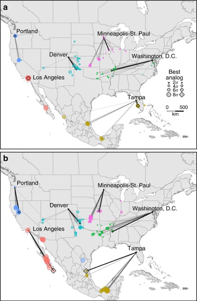
An interactive map created by Fitzpatrick and Robert R. Dunn connects 540 urban areas in the US and Canada to towns and cities where the current environment is similar to what they can expect in the future. The map and the study that goes with it, which was published in Nature Communications, aim to increase awareness of the ramifications of climate change for the roughly 250 million people who live in metropolitan areas across North America.
The outcome is rather scary, so beware.
According to the study’s authors, “we demonstrate that the climate of most urban places would change significantly and either become more similar to contemporary climates hundreds of kilometers away and primarily to the south or will have no modern analogue.”
The map takes into account two scenarios: the first, in which nothing is done to reduce our consumption of fossil fuels and greenhouse gas emissions climb further; the second, in which steps are taken to ameliorate climate change and emissions reach a high in 2040 before falling. The authors discover that if we stick with the first course, the typical town or city’s climate in North America will resemble a site 850 kilometers (530 miles) to the south.

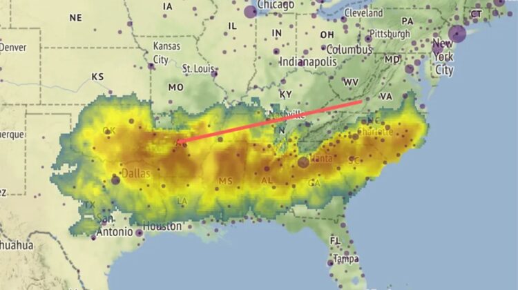
In the worst-case scenario, Washington, DC’s climate will therefore resemble Greenwood, Mississippi by 2080. In the milder case, it might resemble Paragould, Arkansas instead. It’s Jonesboro, Arkansas (the worst-case scenario) or Annapolis, Maryland in New York (mitigated scenario). While in Los Angeles, it’s either essentially unchanged or Las Palmas, Mexico (mitigated scenario).
Fitzpatrick and Dunn assembled data from climate change datasets, including one that examines the current weather, another that takes into account climate projections, and a third that assesses historical climate variability, to generate the map.
Additionally, they calculated the average temperature change for each of the 540 urban regions using a total of 27 distinct Earth system models (530 in the US and 10 in Canada).
The study’s authors continue, “Within the lifespan of children alive today, it is expected that the climate of many locations will change from the familiar to conditions unlike those that their parents, grandparents, or possibly any generation in millennia experienced in the same place.”
“While the general population may not share scientists’ profound concern about the predicted devastating implications of climate change,” the statement reads.
They anticipate that this will alter that.

Leave a Reply